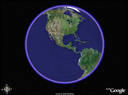
I stumbled upon something called Google Earth. Using satellite images from all over the world, you can "zoom in" and explore. It's like the old Microsoft terraserver, but much better. I guess Google combined with something that used to be called Keyhole (I had never heard of it). Anyway, you simply type in where you want to go, and the software will take you there. The resolution and clarity is much better in some places than in others. For example, most of Michigan is pretty fuzzy, but if you go Seattle you can actually see the Seahawks playing somebody (a goal line stand).
I found some of the places where I used to live, the churches where I've preached, famous ballparks and monuments. It's very user friendly. It has a function where you can have it list street names, churches, schools, etc., so it makes it easy to find things. You can make it seem like you are flying.
Have fun!
P.S. I was doing some reading about this program and someone made an interesting comment: "If this software is available for free and it is easy for everyone and his dog to download and begin to use in a matter of minutes, it's scary to think about what kind of top-secret, high-tech stuff is being used by the military and governments around the world." Yikes! Big brother is watching!
No comments:
Post a Comment